Showing posts with label Grand Canyon. Show all posts
Showing posts with label Grand Canyon. Show all posts
Saturday, December 13, 2014
Thursday, October 22, 2009
Tamarisk Beetles Found in Grand Canyon:
Researchers previously thought that this species of the tamarisk leaf beetle would restrict its range to above the 38th parallel, which is near the upper end of Lake Powell. The beetles were not approved for release within 200 miles of southwestern willow flycatcher habitat, an endangered species which is known to nest in tamarisk - a dominant species in the Colorado River corridor. Tamarisk leaf beetles are now causing defoliation of tamarisk trees further south than originally anticipated. According to Dr. Dan Bean of the Colorado Department of Agriculture, the small population of beetles recently documented in Grand Canyon National Park is unlikely to overwinter successfully. However, it appears likely that as beetle numbers increase a viable reproducing population will be established in Grand Canyon within the next several years.Good news or bad? I'd come down tentatively on the side of good. After all, the whole point of the beetle program is to get them out there eating tammies, and if they're able to do it down south it could be very good for a lot of places I love. But it was somewhat comforting to think that they had geographic limitations.
Reporting on the beetle program is generally rather confused; I never seem to read the same details twice. Tamara Naumann, the park botanist for Dinosaur National Monument and a major driving force behind the beetles, told me this summer that there are actually two species in the mix: the northern-adapted one that was released in Dinosaur, and a more southerly version released (if I remember correctly, which I may not) by the state of Colorado. She also said that there are apparently beetle poachers who are collecting some from release sites and taking them elsewhere.
It's been nice during the last couple seasons in Dinosaur to see some decidedly ratty tamarisk stands. It apparently takes three or four good defoliations to kill the damn trees, so with any luck we'll start seeing real death in the next year or two. Of course, being a biologic control, the beetles are not expected to eliminate tamarisk completely, and then go rampaging about for other things to devour. The best case scenario is that the tammy populations will crash, followed by a beetle crash, followed by a tamarisk rebound, etc. The hope is not that the trees will be eliminated, but that the beetles will bring them under sufficient control that native plants can start competing again and other removal methods will become feasible at select sites. Virtually the only Achilles heel of tamarisk is that it doesn't like shade; there's a hope that if box elders and other natives can get saplings establishes, they may be able to shade out the tammies in places.
If you've just tuned in to this story, I should mention that the decision to use biologic controls was not made lightly. The people behind it, believe it or not, are aware of the risks, disastrous historical precedents, and probably even the relevant Simpsons episode. The decision to release follows over twenty years of lab study, the most intensive study on a biologic control ever. The beetles are very tamarisk specific. Tamarisk has no North American relatives at the genus level, and its only relative in the same family lives in very different (i.e. non-riparian) habitat. The risk is there, but it's low, as low risk as a biologic control can ever be.
Ms. Naumann is humble regarding the introduction, and aware that "future generations may curse my name." She has also worked against other biological control projects where the outlook was more dubious. But she likes to point out that doing nothing was a choice as well, a choice whose consequences were predictable and disastrous, given the high value of the riparian habitat that tammies invade. Of particular concern in Dinosaur are the tammies moving up the Yampa canyon to invade some of the very last cobble bars where the highly-endangered native fish spawn. Introducing the beetles was a calculated risk ; leaving things be was guaranteed to be lousy.
Click here for dystopian tamarisk sci-fi, by a Paonia, CO author.
Thursday, August 28, 2008
Lake Mead: Silt, Superposition & Whitewater
 One of the most interesting parts of my recent Grand Canyon trip was floating past the usual takeout at Diamond Creek and continuing all the way to Lake Mead. I'd never seen this lower stretch before, and it was certainly very beautiful and pretty fascinating. I do not, however, recommend it in August: our daily highs were somewhere in the neighbourhood of 115 F.
 The water level in Lake Mead is currently very, very low. Note the bathtub ring in the photo to the left (click photos for larger, better versions). This was well out within the theoretical perimiter of the so-called lake, and the ring represents the old average pool. This location is also at least 20 miles dowstream of where my map informed me was current's end at the Lake's historic low. Clearly, we've been breaking records for years and years! To add to the general amusement of the place, there were feral bulls wandering about on the river bank.
 Unsurprisingly, the name of the game in the Lake is silt. At the Lake's historic high backwater, still well within the Grand Canyon proper, we began seeing banks of silt covering the river's true banks, and as we continued downstream they grew higher and more extensive. Not infrequently, a section would collapse in our view, avalanching dirt into the river and kicking up prodigious clouds of dust.

 Once you come out of the Canyon into the flats, the silt really spreads out, into a vast plain covered in tamarisk and willow, corresponding of course to the shape of the former reservoir. The old takeout at Lake Mead was Pierce Ferry; the Pierce Ferry boat ramp is now over two miles from the river. Thankfully, things are livened up around here by a new rapid which has been forming and changing frequently for the past couple seasons. In addition to providing amusement, the Pierce Ferry rapid also provides a near perfect, small-scale illustration of the principle of canyon cutting by superposition (for a full account, read about the formation of Lodore Canyon here).
 What's going on here is that, as the Lake level has dropped, the river was not left with its former basin, but rather with the new expanse of flat silt. Unconstrained by its old banks, which are now deep beneath dirt somewhere, the Colorado could meander over the plain rather freely. In many areas, the river of 2008 is far from its old channel. Of course, the current quickly began cutting down and eroding its silty bed, thus fixing its new course somewhat. But in a couple spots, such as Pierce Ferry Rapid, it hit bedrock outcrops a short ways beneath the surface. In the adjacent photo, the silt plain is clearly visible to the right; the bedrock is forming the boulder in the middle and the pourover and whitewater to the sides where the river flows over it. It's probably being eroded very fast; I'm told the rapid is seldom quite the same from one week to the next. The rapid is also much bigger than it looks in this rather dismal snapshot: for instance, the center boulder is easily 25 feet wide, and the whitewater is plenty capable of flipping a loaded boat.
 One of our party running the right channel.
Definitely enlarge this one!
If you imagine a much bigger plain and a lot more bedrock in the picture, it's easy to see how a river becomes entrenched in its own course and incises its meandering path deep into stone.
 Also interesting is where the river finally ends. Current's end is not a gradual process at all; it's almost as abrupt as if someone snapped a chalkline across the water. Upstream, the water is brown and cold; five feet downstream, it's green and warm. The silt is still coming, still settling in. You have to see it to appreciate fully the extent of the siltation problems facing Lakes Powell and Mead.
 The Colorado comes to a halt.
Sunday, August 10, 2008

Sunday, March 09, 2008
Also in Grand Canyon news, there's a new theory of its formation just out which deems its age much greater than previous estimates. While the structure of its constituent rock strata is pretty simple, explaining the formation of the Canyon itself has long been very contentious. "If you ever want to see geologists screaming at each other," an informed person once told me, "ask them to interpret the Grand Wash Cliffs Formation." We'll see how the new theory holds up long-term.
The brief Grand Canyon experimental "flood" is over.
I find that perhaps my previous comment on the flood was somewhat unclear. A longtime reader and friend writes:
With the caveat that I am a plant ecologist and not a geohydrologist, and am not familiar with the Salmon River, I think the problem with doing flooding experiments with the Salmon is that there is no dam and thus no large amount of water to use to mimic a flooding event with. Sure, someone could (and I hope is) studying the flood cycle of the Salmon River, but for controlled experiment's sake a damned [sic, indeed] river is better.(Sorry it's taken me a while to reply, but, well, life gets in the way. And I'm not a geohydrologist either, but I've drunk some beers with them on river trips, so I'll try and do my best to answer.)
The problem with doing flooding experiments in the GC is that there is no large amount of water to use to mimic a flooding event, the dam notwithstanding. Releases from Glen Canyon are determined by a bewildering host of factors: agriculture in California; municipal water needs in Phoenix, Vegas and So-Cal; electricity needs in Arizona; our treaty obligations to provide Mexico with 2 million acre-feet yearly; balancing inflow (i.e., snow melt) with diversions in upper basin states while maintaining useful water levels in three major downstream reservoirs and three major and a host of minor upstream reservoirs. Powell Reservoir has been very low for years now, while water demands continue to increase; no water has reached the Gulf of Mexico since 1982. Under these conditions, sedimentation research in the Grand Canyon is very low on the totem pole.
Indeed, the current flood is really just a small bone thrown to conservationists by the Bureau of Reclamation. Other people besides me are unhappy about the experiment. For instance, the Executive Director of the Grand Canyon Trust:
We need high flows to rebuild habitats whenever we get significant sediment inputs from tributary streams, but instead we get rare, “historic” experiments. We need more natural steady flows through most of the remainder of the year to protect spawning and rearing habitat for humpback chub in the Colorado River, but what we get is continued erosion of backwaters and beaches through an almost unbroken regimen of fluctuating flows... if this high flow experiment is part of a package with no more floods for five years and just two months a year of steady flows, then the package will impair the resources in Grand Canyon.Or the National Parks Conservation Association:
...the experimental plan fails to include follow-up floods, which are critical to ensuring that endangered fish and sandbars are preserved. Instead, it calls for steady releases during September and October over the next five years –essentially locking-in smaller flows from the dam in order to generate additional power – when larger flows might be more beneficial to the park’s ecosystem at other times of the year, particularly in the spring.This "flood's" 41,500 cubic feet per second for 60 hours is a paltry flood in a drainage the size of the Colorado Basin. And we only get this every four years (the last such experiment was in 2004). I have no doubt that these events do provide a wealth of data for scientists, and are useful due to their closely controlled nature, one data set in four years is a pretty plodding pace of research.
The big thing that's missing in the science here is baseline data for the behavior of sediment in a natural river system of this size. No one thought to look at any of this before the dam went in in 1963. And there is precisely one river system in the same ballpark in the United States unaffected by dams: the Salmon. Lets look at some hydrographs (which I got here). Here is the Main Salmon's high water season (April-July) for the last two years
2006, a fairly average year:

2007, a low year:

(Note that the scales are not the same; 2007's peak was about 38,000 cfs, while 2006's was over 90,000. That's a ton of water, and the Salmon can go way bigger than that!) Observe how the high flows are spread out over a good three months. Low elevations melt first, it peaks when the weather really heats up, and lingering snow melt and groundwater keep feeding it, stretching out the right end of the graph. Note also the multiple small peaks.
Now lets look at the Colorado. Here's last week, encompassing the flood:

And here's the last 12 months of business as usual at Glen Canyon Dam, with the flood spike at the far right:

In the flood graph, obviously, we have a sharp rise, a steady plateau and a sharp fall, enormously different from a natural high-water episode. In the lower graph, note that the daily fluctuations are so extreme that they're represented by three separate lines; GC boaters have to be careful when setting up camp to avoid being flooded or having their boats beached. The many little spikes represent weekday vs. weekend flows: they don't need as much electricity Saturday and Sunday when Phoenix office buildings are closed. Note also the increase to power Phoenix A/C in the summer heat.
Is a four day peak long enough to really stir up the sand and put it where we want it? Does the steep right-hand tail of the flood actually do harm by causing beaches to erode into very steep banks, something I've observed non-scientifically in Idaho (Mark Schmeeckle is probably working on this question as we speak)? What would happen if we three one-day floods instead? Is 41,500 cfs at all adequate, or do we really need something closer to historic highs (estimated to have been something like 70,000 to 300,000 cfs on the Colorado pre-dam; again, the Salmon's the only river with at all comparable bed and gradient that gets anything like these flows)? These are the kind of questions which the Salmon's annual natural flood experiment could help answer, without being dependent on the vagaries of western water politics. No, it's not a controlled experiment, but natural scientists commonly use natural experiments to gather data on phenomena for which a deliberate experiment would be irresponsible or impossible. That's how we've gained almost all of our knowledge about things like debris flows, landslides, avalanches and forest fires, let alone earthquakes, volcanism and astronomy.
Also worthy of note is that baseline data for sediment behavior in a natural river system would not be useful only in the Grand Canyon. Lodore Canyon below Flaming Gorge Dam on the Green and the entire Dolores River in Colorado have very similar management issues. I ran Lodore on an experimental flood in 1999 (which was a blast), but there hasn't been another, and we're not likely to see one any time soon. McPhee Reservoir has rendered the Dolores virtually dead for two decades. The Yampa (the last significant undammed river in the Colorado Basin) is also threatened by headwaters diversions and a dam on the Little Snake which would cut off its major source of sediment. Solid baseline data on sediment behavior would greatly benefit conservation proposals for these rivers.
"But what's the point?", you ask. "If the Bureau is so loathe to release a piddling flood for research purposes, we'll never see a flow regime that even vaguely mimics the natural hydrograph." Good point, and alas, very probably true. But you never know: things change. Water issues are only likely to get worse in the Colorado Basin, and if the Colorado River Compact ever comes up for major renovation, conservationists need to have their ducks in a row, with specific proposals instead of just objections. Also, every dam in the Basin is silting up in a big hurry; whether they like it or not, the Bureau is going to have to come up with some new plans eventually, and it would be nice to know how all the silt in the reservoirs is going to behave. Or the drought might even break (hey, I can dream), the dams might someday be looking to release large volumes (as Glen Canyon Dam was forced to do in 1981 and 1983), in which case scientists should be able to tell them how to do it in an ecologically beneficial manner.
You can never have too much data these days, and the Main Salmon is a great place to get some. And there are any number of grad students looking to research their theses is beautiful surroundings*. Grad students, I'm available, I know the Salmon and I'm a good river cook. Science!!!!
*I talked once with a guy who was writing his thesis on box elder trees in Dinosaur National Monument. "So what got you so interested in box elders?" I asked. "They grow here," said he.
Tuesday, February 26, 2008
This & That
The book meme with which Steve has tagged me seems a jolly thing, but my case has failed to produce interesting results. My genuine closest book has most of p. 123 taken up with a large picture. What to do? If I simply follow five sentences onto p. 124 I get
The transmitted sound resembled a high-pitched birdlike warble. The Russians called the novel sonar the CHIRP.My second nearest book had p.123 blank (chapter break). Choice three, my current read, yieldsLate that first night at sea, after about six hours of steaming westward from Gelendzhik, the Aquanaut approached the place where the ancient Don River might once have flowed on its way to the Ice Age Black Sea lake.
"The sun, Mr. Barrow?" said the master. "Mr. Snow, clear me those men to the foc's'le. When is the side to be dressed, bo'sun? We do not have all day."Oh well, monkeys with typewriters can't produce Bartlett's every day."I suggest that hats should be ordered to be worn," said Tobias, plucking Mr. Clerk's coat to draw his attention."
The Querencia blog has had food on its mind lately (no surprise, really). In the comments here, Moro Rogers asked about eating well when one is broke, and the topic has continued. I'll try to post some reflections in the future, but I don't have all night and there's nothing like working on an organic farm to make you really think about food, economics, sustainability and affordability. (Our farmer's wife was so harried that she actually on occasion purchased canned Kroger tomatoes while our beautiful heirlooms rotted in the compost.) The affordability issue really became a serious philosophical concern for us, as we watched all our produce leave its fertile valley to be sold at greatly magnified prices in Colorado's mountain Disneylands. And the farmers still don't make money. It's also true that it can be cheaper than you think, though. But getting the good stuff cheap definitely involves barter, making lots of friends, rural networking, really living in an area. I'll stop rambling for now, but here's another good interview with Michael Pollan.
And finally, they're planning another Grand Canyon flood experiment for this year. Wish I could be on the river! The main purpose of these releases is ecological experimentation, particularly as relates to sediment redistribution (rebuilding eroded beaches), its effects on invasive plants and native fish. I have certainly seen beaches grow dramatically less and the weeds wax much worse in my two decades' experience in the canyon; it's worthwhile science. But a lot of this experimentation could be conducted much more easily, and I hereby offer the following to geomorphologists free of charge, with the stipulation that I be hired as their boatman should they secure funding for this project:
Idaho's Main Salmon River would be a much more convenient venue for sedimentation and beach building research than the Grand. The Salmon is comparable in its channel, gradient and volume to the Colorado, and most importantly it is undammed. Instead of planning occasional manmade floods amidst the minefield of agency politics, Colorado water allocation and power generation requirements that beset the Grand, researchers could avail themselves of a natural experiment in Idaho annually. The Salmon commonly has peaks from 40,000 to 120,000 cfs, again comparable to the pre-dam Colorado and boasting high volumes that Reclamation would never agree to. The specific hydrograph (swift vs slow rise and fall, multiple peaks, &c.) also varies greatly, and we commonly observe large variations in the beaches from year to year. It's a superb natural laboratory, and the Canyon folks should take advantage of it. And secure lavish funding for their boatmen.

Thursday, April 05, 2007
Oh, very well. Last night's post inspired me to spend a little more quality time with the scanner before packing it away. Let's put proper closure on the Grand Canyon photos. First, another shot to make you wish you lived at Havasu:

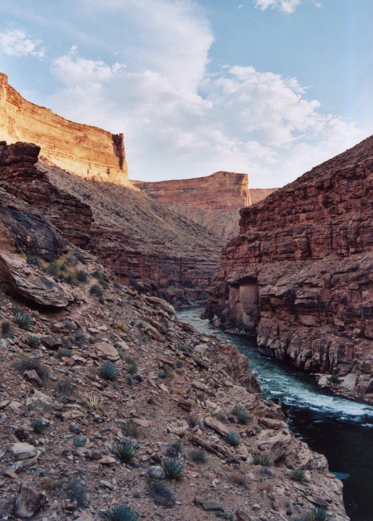
The western Grand Canyon is vast, harsh and very little explored away from the river, especially in summer. The heat is satisfyingly punishing, frequently reaching the 110-115 degree range. One of our group reported that when he woke up at 2:00 in the morning, his watch thermometer still read 99. The heat is frequently accompanied by winds, intensifying the blast furnace effect and bereft of the slightest trace of moisture. Straying far from the water is intolerable; sometimes one has to get soaking wet in the evening to get to sleep, and even repeat the procedure after an hour or two. It's a very satisfying desert experience.

An action shot from Mrs. Peculiar, yours truly on the oars:

Another notable difference between the lower Canyon and the more frequently depicted upstream sections is the presence of lava. In the very recent geologic past, a number of volcanoes burst out of the Uinkaret Plateau, which forms the northwestern rim of the Canyon and is one of the most remote chunks of the lower 48. The Grand Canyon already existed in pretty much its present form, and the lava flows ran southward and dropped off the rim. In some areas you can see clearly where the lava flowed between butresses in the walls and around obstacles. A more dramatic spectacle of geology is hard to imagine!
 (Note the darker rocks forming a horizontal band at center: that's the lava.)
Despite the post-apocalyptic heat and dryness, the area is subject to punishing thunderstorms, such as this one from our last night on the river:

These storms in the lower Canyon are a significant source of anxiety for boaters, inasmuch as the takeout road up Diamond Creek is notoriously eager to flash flood. A friend of mine once witnessed two commercial outfits' vehicles, Mack truck-sized rigs, being rolled over and over in a debris flow accompanied by plenty equally large boulders. They're in Diamond Creek Rapid now, along with numerous others, no doubt.
Fortunately for us, damage to the road was minor and only delayed our shuttle vehicle by an hour or so. Here's the scene, with us and two other parties waiting for our rides. The creek and I are both in the middle of the road.

Stay tuned: one more photo post to come.
Wednesday, April 04, 2007
Mrs. Peculiar and I are undergoing the dubious joys of moving presently, gearing up for six months or more of sweet seminomadism. As I'm not of the type who has WiFi devices implanted in his body, nor any similar arrangements, my days of regular blogging are numbered, numbered to about four, to be precise. (Incidentally, the next person who pesters us about an infernal cell phone, because, "How, oh how, will all and sundry keep in constant, pestersome touch?", is highly liable to lose the tip of her nose.) Therefore, here is a last set of Grand Canyon photos.
The Grand Canyon is well known for it's whitewater, but the rapids are remarkably difficult to catch on camera without highly inconveniencing everybody. But to give you an idea, here's a shot of Granite from a trip several years ago:

Here's Mrs. Peculiar beside Tapeats Creek, an intursion of moist lushness into a vertical, stony desert:

A major tributary of Tapeats Creek is Thunder River, which bursts out of a hole in a limestone cliff and cascades without delay straight down the side of the Grand Canyon. Click to enlarge, and note the three hikers just left of center for scale:

Looking back towards Tapeats from Thunder Spring. Our more geologically astute readers will note a visibly slanted pink layer at the canyon bottom. That is Shinumo Quartzite; it and its siblings of the Grand Canyon Supergroup were laid down flat in Proterozoic times, tilted to their present angle, eroded, and then covered with Tapeats Sandstone at the bottom of a Cambrian sea, followed by the many, many other sedimentary layers of the Colorado Plateau:

A little downstream from Tapeats, Deer Creek falls from a sandstone slot 150 feet into the Colorado. Sorry about the lack of scale; a person at the base of the falls would be treading about eight feet of water in the pool while being peppered with bullets of spray:

Finally, a shot of the idyllic Havasu Creek. Everyone on earth would want to live there if it weren't scoured by 20-foot walls of water every decade or so:

I do have some worthwhile shots of the less-photographed lower canyon, but they aren't scanned and I'm not optimistic about making that happen by Sunday.
Monday, March 12, 2007
It's been a while since I posted any Grand Canyon pictures. By the fourth day or so on the water, you're getting into the Grand Canyon proper, the deep part that is commonly seen on calendars and such.

About fifty miles in is the confluence with the Little Colorado. The L.C. has an enormous drainage area, stretching all the way into western New Mexico. It is a very dry drainage, however, and for most of its length the L.C. has water only by way of flash flood, usually during the summer rains. But four miles upstream from the confluence is a place called Blue Springs, which produce a very respectable volume of water. The water is milk warm and cloudy blue due to high amounts of travertine, i.e. calcium carbonate, i.e. disolved limestone. The travertine builds up into extensive Baroque terraces and ledges. It's an idyllic place when the water is running clean and blue; but ater mid-July it is common to find it flowing thick chocolate brown due to flooding somewhere upstream.
When we arrived, the L.C. was blue, but a bit milkier than normal. We spent forty-five minutes or so swimming in the warm water, a welcome change from the 45 degrees of the main Colorado, floating through small rapids. We soon noticed the canyon of the Little Colorado filling with dense blue-gray thunderheads. Heavy desert summer raindrops began falling as we hightailed it back to the boats.
 Mrs. Peculiar swims a Little Colorado rapid
The area around the L.C. confluence is of prime cosmological importance to the Hopi. A few miles up the L.C. near Blue Springs is the sipapu, a travertine formation that the Hopi believe is the hole of egress whence man and animals emerged from the lower world into this one. This sipapu is symbolically represented by a small hole in the floor of every kiva, both Hopi and Anasazi.
In the miles below the conflunce are numerous deposits where salt leaches from the canyon walls. The Hopi still make annual pilgrimages to gather their salt for the year here. They leave feathers and other offerings, which are considered to have crossed over to the Kachinas' world once they are completely encrusted in salt.

Floating past the Hopi salt mines on a stormy afternoon
Wednesday, October 11, 2006
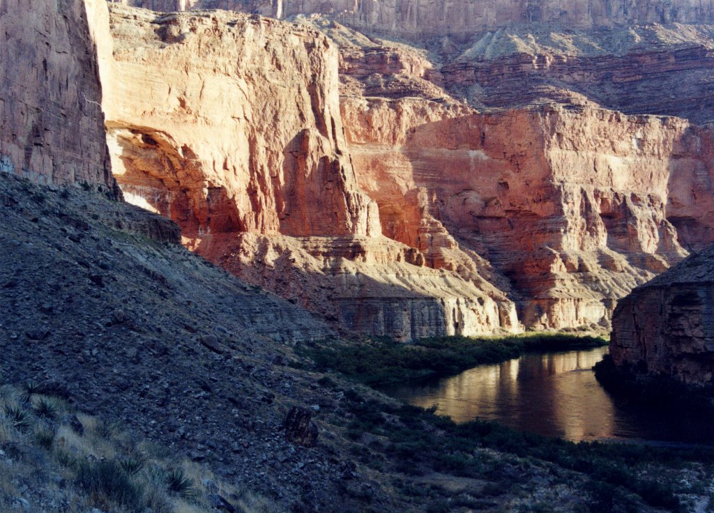
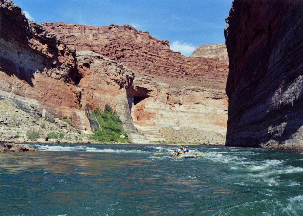
Vasey's Paradise, one of many springs that flow from the Grand Canyon's walls. The Redwall Limestone is highly water permeable and riddled with caves. It's lower neighbour, the Muav Limeston is much less permeable, so a large number of springs in the Canyon issue forth at the Redwall-Muav contact. The spring at Vasey's has noticeably diminished in volume over the years, even within my own memory. It is one of the few homes of the endangered Kanab Land Snail (the Park Service occasionally issues risible missives exhorting the public to "minimize human-snail conflict"), and up close is well-endowed with red monkeyflowers and poison ivy. 
Friday, September 15, 2006
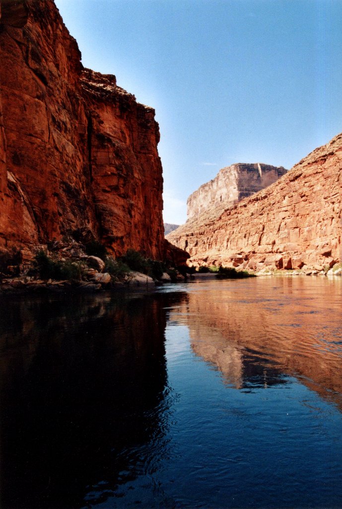
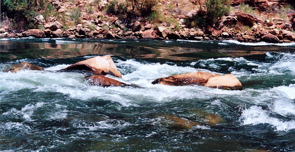
The entrance to North Canyon Rapid. The viewer will observe the emerald clarity of the water, not colorado at all; the water is also quite cold, in the mid-40s. This is the effect of Glen Canyon Dam. Historically, the Colorado ran warm and thick red, coloured by the vast erosional forces of its upstream basin. Glen Canyon Dam was built largely as a silt trap for Lake Mead, and itsreservoir (Lake Powell) is filling with silt far, far faster than was hoped. The clear, green water is beautiful, even I can't deny it. Fortunately, we are frequently allowed to see what the river looked like pre-dam, thanks to the common flash flooding of the numerous side canyons. Pictures to come!

Thursday, September 14, 2006


Subscribe to:
Posts (Atom)